A Mountain explodes
 In 2005 we were on our way south along the U.S. West Coast when we decided to pay a visit to Mt. St.Helens.
I had previously seen the mountain only 4 years after the explosion in 1984. Now I wanted to show the place to Bea and also see what changes had taken place over the last 20 years.
We were coming down I-5 and got into the Mt. Rainier/Mt. St.Helens neighbourhood. Looking for an RV-Park we chose a rather shabby RV/Mobile Home-Park south of Vader. Despite dark clouds coming up, we decided to see Mt. St.Helens the same day. So we took off on Hwy 504 west from Castle Rock.
 |
| Park Entrance |
The road led us more than 60 km's up into the mountains. In front of us the Cascade range appeared with its sharp and rocky peaks. Mt.St. Helens top was hidden in the clouds which lay draped like a blanket around.
 |
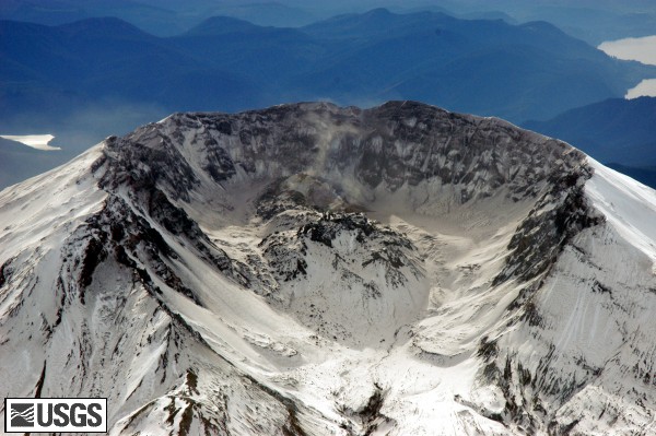
| The Crater as it was left after the eruption |
 |
| Mt.St.Helens prior to the eruption |
We drove all the way to Johnson Ridge where an observatory was build after the eruption.
 |
| Tree blown down by the blast in 1980 |
Very dark clouds appearing everywhere reminded us on our return. Before we reached I-5 the rain was pouring down.A nice warm trailer and a good meal let us forget about the bad weather coming up.
Facts about Mt.St.Helens
The eruption was preceded by a two-month series of earthquakes and steam-venting episodes, caused by an injection of magma at shallow depth below the volcano that created a huge bulge and a fracture system on Mount St. Helens' north slope.
USGS scientists convinced the authorities to close Mount St. Helens to the general public and to maintain the closure in spite of pressure to re-open it; their work saved thousands of lives.
An earthquake at 8:32:17 a.m. PDT on Sunday, May 18, 1980, caused the entire weakened north face to slide away, suddenly exposing the partly molten, gas- and steam-rich rock in the volcano to lower pressure. The rock responded by exploding a hot mix of lava and pulverized older rock toward Spirit Lake so fast that it overtook the avalanching north face.
An eruption column rose 80,000 feet (24,400 m) into the atmosphere and deposited ash in 11 U.S. states. At the same time, snow, ice and several entire glaciers on the volcano melted, forming a series of large lahars (volcanic mudslides) that reached as far as the Columbia River, nearly fifty miles (eighty kilometers) to the southwest. Less severe outbursts continued into the next day only to be followed by other large but not as destructive eruptions later in 1980.
Fifty-seven people (including innkeeper Harry R. Truman, photographer Reid Blackburn and geologist David A. Johnston) and thousands of animals were killed. Hundreds of square miles were reduced to wasteland, causing over a billion U.S. dollars in damage ($2.74 billion in 2007 dollars, and Mount St. Helens was left with a crater on its north side. At the time of the eruption, the summit of the volcano was owned by the Burlington Northern Railroad, but afterward the land passed to the United States Forest Service. The area was later preserved, as it was, in the Mount St. Helens National Volcanic Monument.

Really good blog!
ReplyDelete